Квадрокоптеры Yuneec H520E (YUNH520EEU) - инструкция пользователя по применению, эксплуатации и установке на русском языке. Мы надеемся, она поможет вам решить возникшие у вас вопросы при эксплуатации техники.
Если остались вопросы, задайте их в комментариях после инструкции.
"Загружаем инструкцию", означает, что нужно подождать пока файл загрузится и можно будет его читать онлайн. Некоторые инструкции очень большие и время их появления зависит от вашей скорости интернета.
20
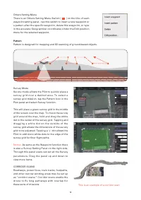
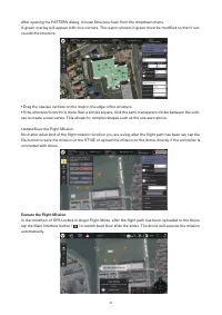
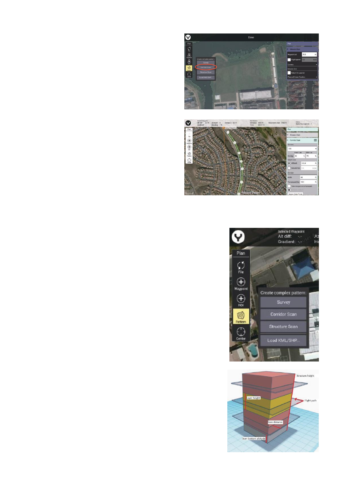
To create the CORRIDOR SCAN, tap the “Pat-
tern” soft key, and select CORRIDOR SCAN.
The CORRIDOR SCAN Setting Panel will open
with a base, straight, CORRIDOR SCAN in place
The small “+” symbol in the vertex allows addi-
tional vertices to be created/inserted in the path-
way, allowing for numerous angles to follow the
r o a d ( a s s e e n i n t h e i m a g e o n t h e p r e v i o u s
page).The aircraft will fly the white lines detailed
in the pathway.
Notice:
Be similar with the Waypoint function
the CORRIDOR SCAN Setting Panel shown on
the right side. Through this panel users can set
all the CORRIDOR SCAN parameters. Drag the
panel up and down to view more items.
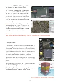
STRUCTURE SCANS
A Structure Scan allows users to create a grid flight pattern that
captures images over vertical surfaces (e.g. walls) around a
structure with an arbitrary polygonal (or circular) ground foot-
print. Structure Scans may be combined with nadir/survey
flights to better serve architects, engineers, and construction
companies looking to create accurate 3D models, or output .las
files to products such as Revit or Autodesk workflows.
Structure scans may also be used for virtually any vertical scan
element, and may be combined with other automated flight
profiles
Structure Scans may be inserted into a mission using the Plan
view PLAN | PATTERN | Structure Scan tool.
Using the map function, zoom to the geographic area to be
scanned, and center it on the screen for best access.
In this image,
seven vertices have been inserted, allowing the Drone to follow the curvature of the roadway.
The concept of the STRUCTURE SCANS Function
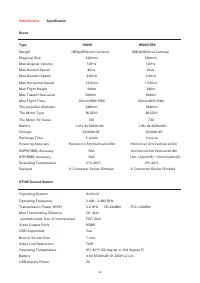
Характеристики

Остались вопросы?Не нашли свой ответ в руководстве или возникли другие проблемы? Задайте свой вопрос в форме ниже с подробным описанием вашей ситуации, чтобы другие люди и специалисты смогли дать на него ответ. Если вы знаете как решить проблему другого человека, пожалуйста, подскажите ему :)


