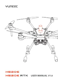
Квадрокоптеры Yuneec H520E (YUNH520EEU) - инструкция пользователя по применению, эксплуатации и установке на русском языке. Мы надеемся, она поможет вам решить возникшие у вас вопросы при эксплуатации техники.
Если остались вопросы, задайте их в комментариях после инструкции.
"Загружаем инструкцию", означает, что нужно подождать пока файл загрузится и можно будет его читать онлайн. Некоторые инструкции очень большие и время их появления зависит от вашей скорости интернета.

19
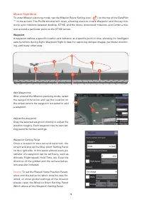
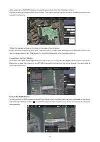
Others Setting Menu
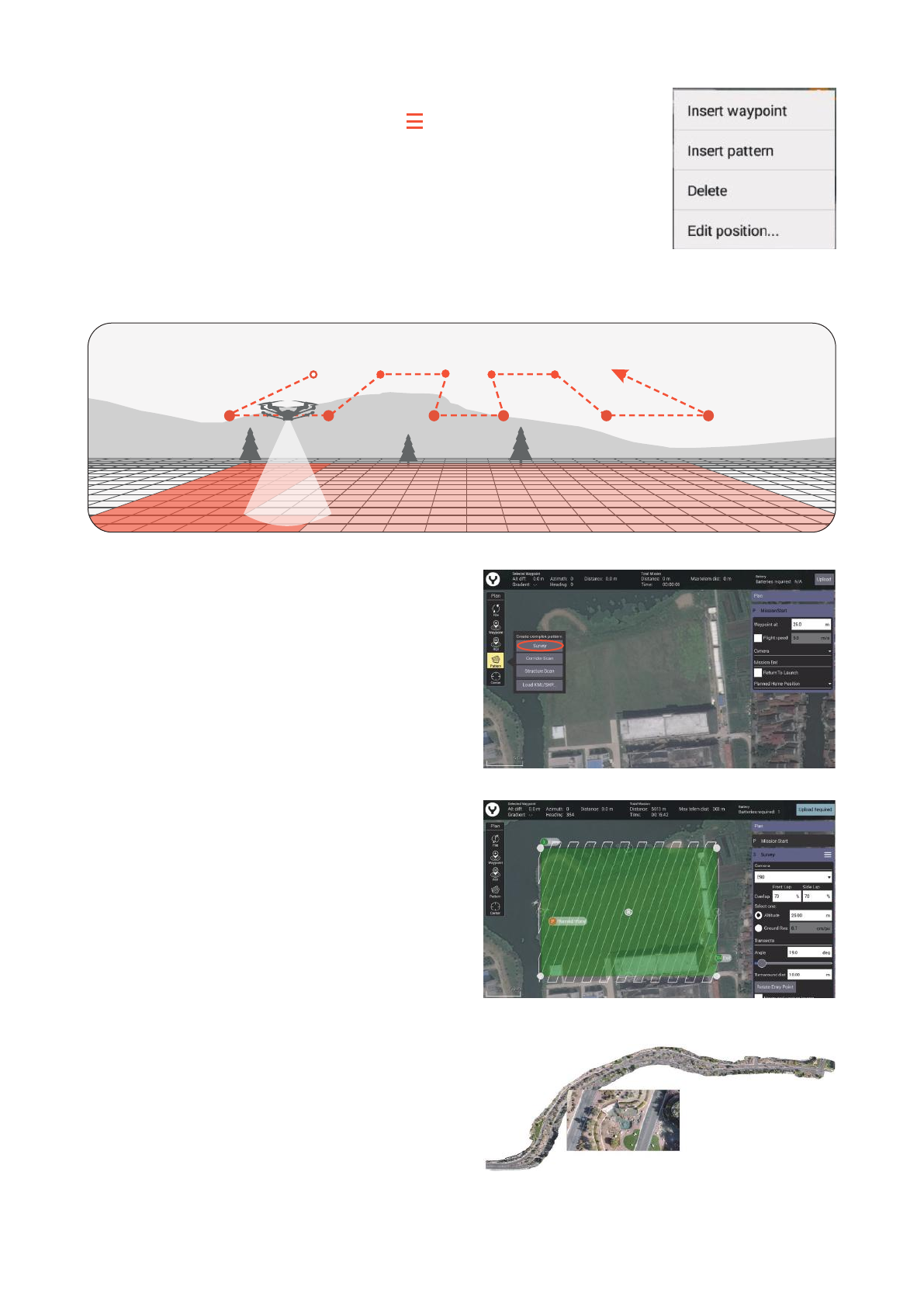
There is an Others Setting Menu Switch [ ] on the title of each
waypoint setting panel , tap this switch to insert a new waypoint or
a pattern after the specific waypoint, delete this waypoint, or type
in the accurate Geographical coordinates Under the Edit position
menu for the selected waypoint.
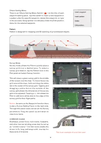
Pattern
Pattern is designed for mapping and 3D scanning of ground-based objects.
Survey Mode
Survey mode allows the Pilot to quickly place a
s u r v e y g r i d o v e r a d e s i r e d a r e a . T o s e l e c t a
survey grid mission, tap the Pattern Icon in the
Plan panel and select Survey function.
This will place a green survey grid in the middle
of the screen over the map. To move the survey
grid around the map, hold and drag the white
dot in the center of the survey grid. Tapping and
d r a g g i n g a w h i t e d o t o n t h e o u t s i d e o f t h e
survey grid allows the dimensions of the survey
grid to be adjusted. Tapping a ‘+’ dot allows the
Pilot to add more white dots to the edge of the
survey grid for finer flight paths.
Notice:
As same as the Waypoint function there
is also a Survey Setting Panel on the right side.
Through this panel users can set all the Survey
p a r a m e t e r s . D r a g t h e p a n e l u p a n d d o w n t o
view more items.
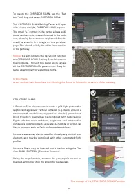
CORRIDOR SCANS
Roadways, power lines, train tracks, footpaths,
and other narrow winding areas may be set up
as “corridor scans.” Corridor scans enable the
d r o n e t o fl y l o n g p a t h w a y s w i t h o v e r l a p f o r
these sorts of missions
This is an example of a corridor scan
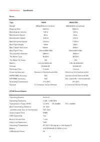
Характеристики

Остались вопросы?Не нашли свой ответ в руководстве или возникли другие проблемы? Задайте свой вопрос в форме ниже с подробным описанием вашей ситуации, чтобы другие люди и специалисты смогли дать на него ответ. Если вы знаете как решить проблему другого человека, пожалуйста, подскажите ему :)


