Навигаторы Navitel F150 - инструкция пользователя по применению, эксплуатации и установке на русском языке. Мы надеемся, она поможет вам решить возникшие у вас вопросы при эксплуатации техники.
Если остались вопросы, задайте их в комментариях после инструкции.
"Загружаем инструкцию", означает, что нужно подождать пока файл загрузится и можно будет его читать онлайн. Некоторые инструкции очень большие и время их появления зависит от вашей скорости интернета.
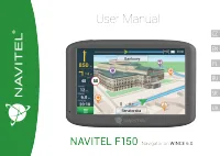
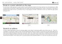
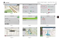


QUICK START GUIDE — NAVITEL F150
| 29
EN
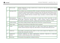
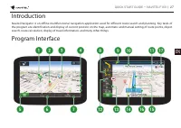
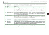
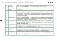
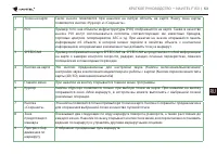
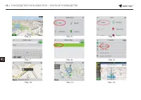
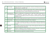
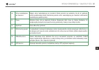
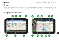
10
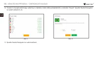
Street after
maneuver
The name of a street following the maneuver. Please note that if certain conditions are met,
the upcoming traffic lanes will be displayed instead.
11
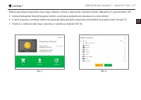
Route
Active route.
12
Speed
Road speed limit is displayed next to the current car speed. The program will notify the driver
in case any traffic violations are taking place – orange colour block for set overspeeding
level (by default its 10 km/h), red one for over the set overspeeding. It is possible to set
the speeding level for orange notification up to 30 km/h in the Alerts section of Settings.
13
Information panel By default, displays a set of gauges that provide information on remaining travel time,
distance to the point of destination, and estimated arrival time. The selection of gauges
can be changed in the program settings.
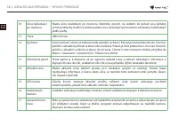
14
Current street
The name of the current street (active only when connection with satellites is established).
If the map does not contain information about the active street name, the direction of
movement is displayed instead (North, South, West, and East).
15
GPS cursor
Green cursor displays the current location of the device; gray cursor displays the last known
location, if the current one is not defined.
16
Indicator of
maneuver
When passing the roads with two or more lanes this indicator displays information about
the permitted maneuver at the nearest intersection or turning point; progress bar under
the indicator displays the distance left to the described maneuver.
17
Road regulations
On the right side of the display program indicates the distance left to the closest driving
regulations. When approaching, the program displays the countdown to the closest
camera, road sign or marking.
Содержание
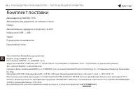
- 54 Комплект поставки
- 55 Информация о безопасности
- 56 Использование
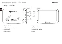
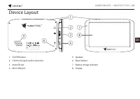
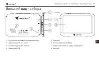
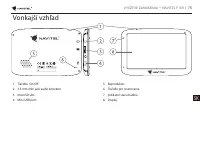
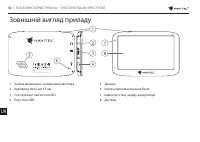
- 57 Внешний вид прибора
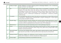
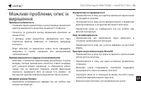
- 58 описание их решения
- 59 Уход за прибором
- 60 Безопасное управление
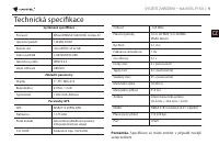
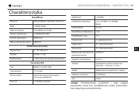
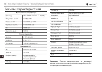
- 61 Технические характеристики
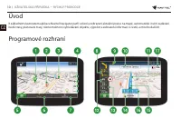
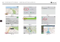
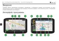
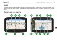
- 62 Введение; Интерфейс программы
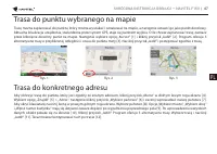
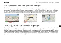
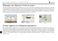
- 65 Маршрут до точки, выбранной на карте
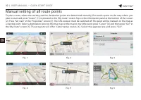
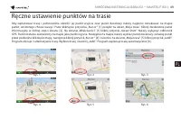
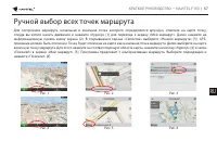
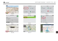
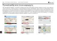
- 67 Ручной выбор всех точек маршрута
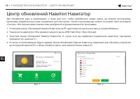
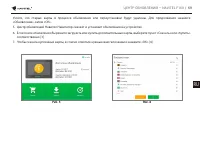
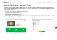
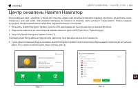
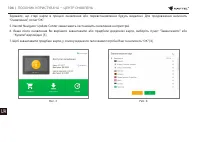
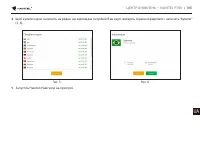
- 68 Центр обновлений Навител Навигатор


